
Detailed Documentation of Classes and Associations
The ICSM Feature Catalogue contains a description of Classes, Attributes and Relationships presented in the Harmonised Data Model. It is available as an MS Access file and can be downloaded. Users can view or print specific parts of the catalogue. Alternatively the entire catalogue may be printed (in excess of one hundred pages):
The ICSM Feature Catalogue has been prepared to conform to International Standard ISO 19110 - Feature Cataloguing Methodology.
Policy and Guidelines for Incremental Update
Incremental update is a component of the ICSM Harmonised Data Model. For this purposes incremental update is defined as:
a data transfer system that enables suppliers to supply only information that has been affected by change between two versions of a dataset and for users to be able to incorporate those changes into their data .
This document includes the policy for incremental update to be adopted for ICSM-sponsored datasets, and guidelines as to how the policy might be applied. The approach that has been adopted is one of setting minimal standards because there are several different approaches to incremental update already implemented by different jurisdictions and because data users as well as suppliers also participate in the incremental update process. The users may need to modify their approach to suit their individual circumstances.
The Model
Overview and Common Elements
1.0: Harmonised Model and Dependencies on ISO Standards
Diagram and Documentation for 1.0
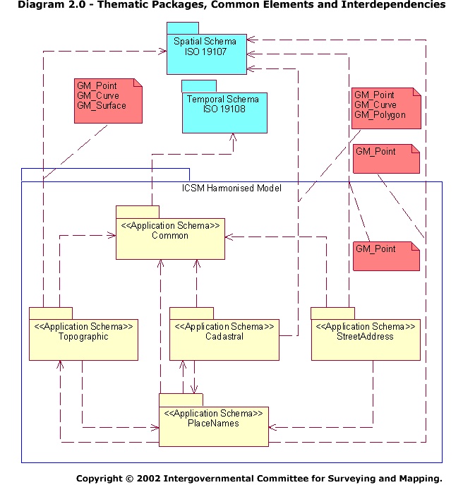
2.0: Thematic Packages, Common Elements and Interdependencies
Diagram and Documentation for 2.0
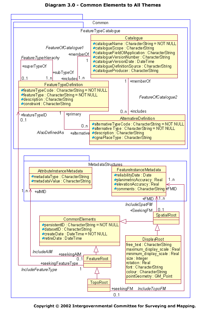
3.0: Common Elements to All Themes
Diagram and Documentation for 3.0
Cadastral
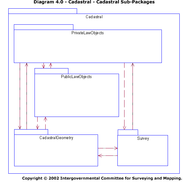
4.0: Cadastral - Cadastral Sub-Packages
Diagram and Documentation for 4.0
4.1: Cadastral - Non-Geometric Classes
Diagram and Documentation for 4.1
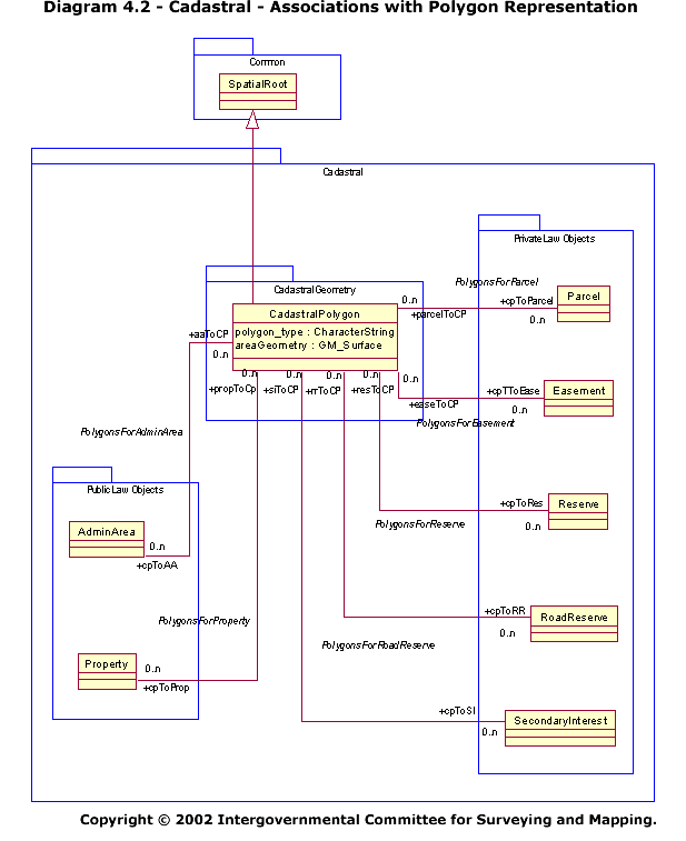
4.2: Cadastral - Associations with Polygon Representation
Diagram and Documentation for 4.2
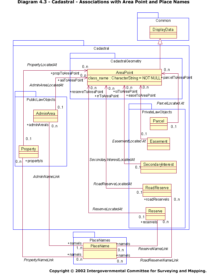
4.3: Cadastral - Associations with Area Point and Place Names
Diagram and Documentation for 4.3
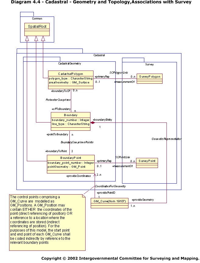
4.4: Cadastral - Geometry and Topology, Associations with Survey
Diagram and Documentation for 4.4
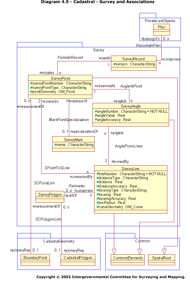
4.5: Cadastral - Survey and Associations
Diagram and Documentation for 4.5
Topographic
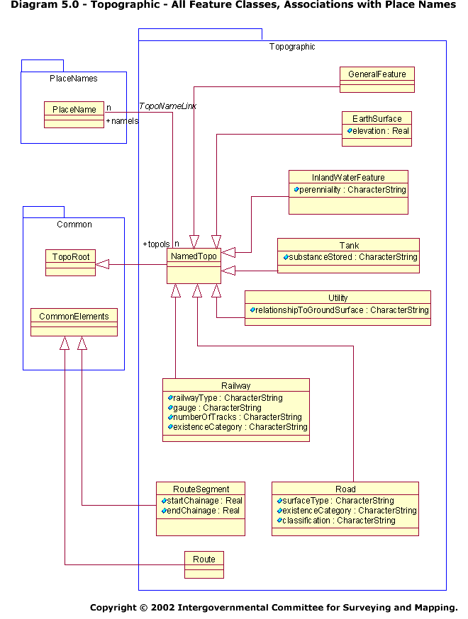
5.0: Topographic - All Feature Classes, Associations with Place Names
Diagram and Documentation for 5.0
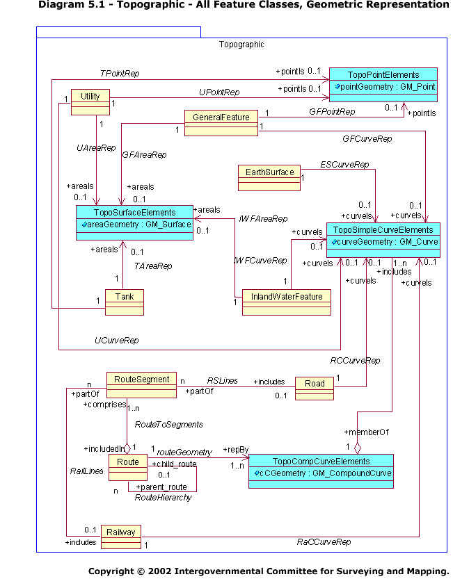
5.1: Topographic - All Feature Classes, Geometric Representation
Diagram and Documentation for 5.1
Place Names
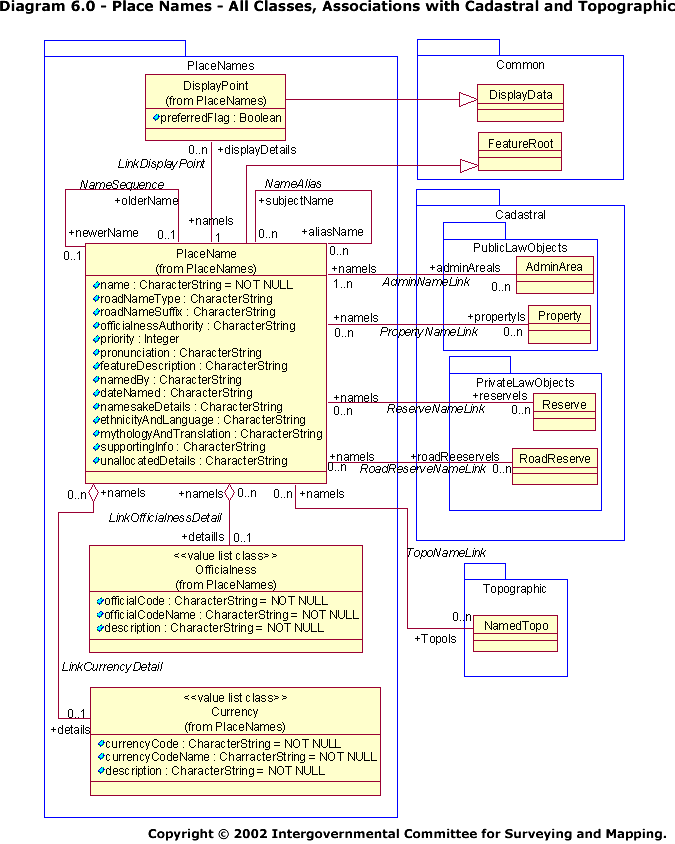
6.0: Place Names - All Classes, Associations with Cadastral and Topographic
Diagram and Documentation for 6.0
Street Address
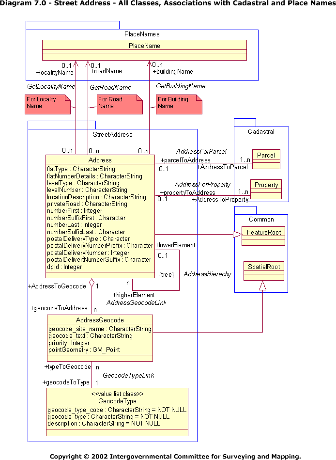
7.0: Street Address - All Classes, Associations with Cadastral and Place Names
Diagram and Documentation for 7.0