The ICSM Cadastral Working Group has developed a Standard for the Accuracy of Spatial Cadastres in Australia and New Zealand.
This Standard establishes Australian and New Zealand targets and a reporting framework for the accuracy of the horizontal position of parcels within Spatial Cadastres.
The Standard also requires attributing Positional Uncertainty to points, lines and/or polygons within the Spatial Cadastre. Attribution is limited to the parcels and does not include 3D data and boundaries based on natural features such as creeks, tidal lines etc.
Standard for the Accuracy of Spatial Cadastres in Australia and New Zealand v1.0.pdf
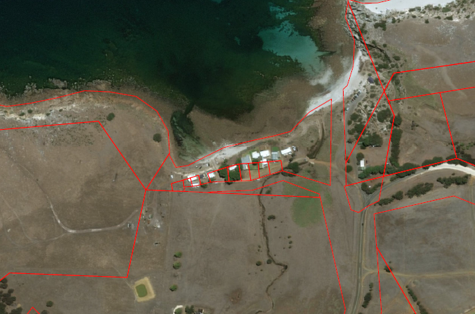
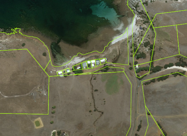
The following images illustrate the effects of improving the spatial accuracy of a spatial cadastre: