CHAIRMAN’S FOREWORD
Mr Paul Harcombe

As the standing Committee of ANZLIC, ICSM continues to implement the strategic policy vision of ANZLIC, the Spatial Council.
ICSM’s main strength is an ability to bring together subject matter experts from multiple jurisdictions to find national solutions and approaches to Australia’s geospatial challenges.
ICSM delivers the practical and technical strategies, standards, guidelines, manuals and resources that enable a federated Australia to achieve outcomes that are greater than the sum of our individual abilities and contributions.
Communication with a clear understanding of ANZLIC’s goals and our requirements is vital to ICSM. A Communication Strategy and Plan have been developed and the Chair of ICSM now attends every ANZLIC meeting to ensure a closely aligned relationship.
Some of the major initiatives and achievements during 2012–2014 have been:
- Evolution and development of the ANZ Foundation Spatial Data Framework.
- Completion of the AuScope Very Long Baseline Interferometry (VLBI) Build Program.
- Publication of a totally revised Special Publications for Control Surveys (SP1) and the Australian Tides Manual (SP9).
- Multiple collaborative projects under the National Topographic Information Coordination Initiative (NTICI) banner, between the Commonwealth and the States to capture, amongst other things, all of Australia’s maritime boundaries; infrastructure in parts of Queensland and Tasmania; rural and remote buildings and farm dams.
- An additional online educational resource Fundamentals of Land Boundaries; to complement the very popular Fundamentals of Mapping.
- Australian Standard 5480 on Subsurface Utility Information was published in May 2013 with ICSM / ANZLIC being represented on the Drafting Committee.
- Development of a strategy (Cadastre 2034) for a national approach to reform and innovate Australia’s cadastral systems was initiated.
A more expansive and detailed list of ICSM’s achievements follows in this report.
Mr Bill Watt, the long serving Chair of the Committee for Geographic Names in Australia was elected unopposed to the prestigious position of Chair, United Nations Group of Experts on Geographic Names (UNGEGN) for the five year period 2012–2017. This is a significant achievement and a further measure of Australia’s ongoing leadership in global (geospatial) affairs.
During 2012–2014, the ICSM membership went through a period of major change with 6 of the 12 jurisdictions replacing their members after retirements. This has brought new members with fresh perspectives to help meet the future challenges.
I would like to acknowledge the valuable contributions made by the following members over many years who retired or moved on during this period:
- Peter Kentish, Surveyor–General of South Australia
- Peter Murphy, Surveyor–General of Tasmania
- Garry West, Surveyor–General of Northern Territory
- Dr Don Grant, Surveyor–General of New Zealand
- Dr Lesley Arnold, Manager, Location Products and Services, Western Australia
- Commodore Rod Nairn, RAN, Hydrographer of Australia
and welcome the following new members:
- Michael Burdett, Surveyor–General of South Australia
- Michael Giudici, Surveyor–General of Tasmania
- Craig Sandy, Director Surveys, Northern Territory
- Mark Dyer, Surveyor–General of New Zealand
- Paul Duncan, Director, Location Knowledge Services, Landgate, Western Australia
- Commodore Brett Brace, RAN, Hydrographer of Australia.
To all members of ICSM and Working Groups and our hardworking Executive Officer, Lesley Waterhouse, I would like to extend a sincere thank you for all your dedication and commitment in delivering ICSM’s important achievements.
Paul Harcombe, Chair
1 July 2012–30 June 2014
Achievements During 2012–2014
- ICSM accepted an invitation by ANZLIC to be sponsor of seven FSDF themes and to have a major contributing role in the other three themes.
- Development and launch at Locate14 of the national cadastre strategy, Cadastre 2034
- National Topographic Information Coordination Initiative (NTICI) program was refreshed with new project agreements being signed under the ICSM Collaborative Head Agreement to enable better coordination and collaboration between jurisdictions.
- Completion of AuScope build program:
- The construction of the three radio telescopes for VLBI (Hobart, Katherine and Yarragadee) and a routine observation campaign commenced.
- Very Long Baseline Interferometry (VLBI) data correlation facility at Curtin University established.
- FG5 Absolute gravimeter and 3G–phone earth tide meters are now being used for observations.
- An absolute gravity inter–comparison facility has been established at Mt Stromlo near Canberra.
- The Satellite Laser Ranging (SLR) upgrade completed.
- The development of the AuScope GNSS network is complete.
- The development of the Fundamental gravity network is complete.
- Major progress on the technical side of the datum modernisation project.
- Publication of Version 2 of SP 1.
- Version 2.4 of Australian Tides Manual published.
- Mr Bill Watt elected as UNGEGN Chair for 5 years.
- Dynanet software developed and released on NCI.
- Standard for Subsurface Utilities was developed and published.
- Fundamentals of Land Boundaries now published as web pages.
- The relationship between tidal levels and the ellipsoid at the continuously operating tide gauges was determined.
- Reg 13 weeks held in 2013 and 2014. The primary objective of these campaigns is to improve the consistency of legal traceable CORS positions across Australia; and the stated uncertainties on previously certified stations.
- Extensive groundwork being carried out by all committees and work groups as part of the FSDF.
- The website was refreshed through a new design and restructure.
- Development of communication strategy and plan.
- Release of the 2012 National Gazetteer.
COLLABORATIVE INITIATIVES
3D Cadastre with Melbourne University:
- Completion and presentation by Melbourne University of Land and Property Management in 3D.
Other Initiatives:
- Joint presence with ANZLIC at the Locate14 conference in Canberra.
About ICSM
Our vision
National land and marine spatial infrastructure providing sustainable benefits for Australians and New Zealanders
Our role
To provide leadership, coordination and standards for surveying, mapping/charting and foundational spatial data.
Who we are:
The Intergovernmental Committee on Surveying and Mapping (ICSM) is a standing committee of ANZLIC, the Spatial Information Council.
ICSM members represent 11 jurisdictions and are senior representatives of Australian and New Zealand commonwealth, state and territory surveying, mapping and hydrographic charting agencies.
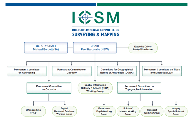
ICSM is supported by a network of permanent committees and working groups. Working group members come from key government, academic, and private organisations from within Australia and New Zealand.
National |
Australian State/Territory |
|
|
National
- Australia–civilian
- Australia–military (terrestrial and marine)
- New Zealand
Australian State/Territory
- Australian Capital Territory
- New South Wales
- Northern Territory
- Queensland
- South Australia
- Tasmania
- Victoria
- Western Australia
What we do:
As a key coordinating body in Australia and New Zealand for surveying and mapping issues, ICSM provides a forum that enables the exchange of information and ideas.
Our function is to:
- provide national coordination of surveying and mapping activities and research
- establish protocols and technical standards for spatial data and related infrastructure
- support the acquisition and maintenance of datasets forming the foundation data framework
- develop and publish best practice guidelines, national technical policies, standards, specifications and data models for foundation spatial data
- encourage a consistent approach across jurisdictions to spatial data policies, standards, programs and priorities
- provide technical advice and support to other coordinating bodies
- promote data integration
- provide a forum to share knowledge, experiences and expertise for foundation spatial data
- communicate and develop relationships with key stakeholders in government, industry and the user community.
How we add value:
ICSM’s activities support government and industry, and:
- provide national coordination, encouraging efficiency through consistency and cooperation, sharing best practice, and reducing duplication
- create enabling infrastructure (including products)
- support networking, learning and innovation across the surveying and spatial information sector
- increase advocacy for spatial information and surveying to improve efficiency and decision making.
How we work:
The ICSM Terms of Reference and Governance Charter is a set of rules that govern the conduct of our activities.
ICSM meets every six months and informs stakeholders of progress and activities through publications on our website and through email.
A Chair is appointed from the Committee every two years and an ICSM Executive Officer delivers secretariat and project support to members, Permanent Committees and working groups.
ICSM invites subject matter experts and key stakeholders to attend meetings to discuss items of mutual interest.
History
Prior to 1988, the National Mapping Council (NMC) coordinated Australian mapping programs. Although the NMC had been an effective forum, the changing operational environment required the formation of a national organisation to cover both surveying and mapping issues.
ICSM was established by the Prime Minister, State Premiers, and the Chief Minister of the Northern Territory in 1988. The Australian Capital Territory and New Zealand also joined ICSM.
In 2002 ICSM became a standing committee of ANZLIC—the Australian and New Zealand Spatial Information Council.
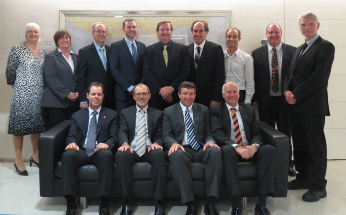
Standing, left to right:
Lesley Waterhouse (ICSM EO), Capt Jenny Daetz (AHS), Russell Priebbenow (Qld), Paul Duncan (WA)
Paul Harcombe (NSW and ICSM Chair), John Tulloch (Vic), Simon Costello (Aust), Gary Johnston (Aust), Bill Hirst (ACT)
Seated, left to right:
Michael Giudici (Tas), Michael Burdett (SA and ICSM Deputy Chair), Craig Sandy (NT)
Mark Dyer (NZ)
(Absent from photo – Graham Johnston (AGO),
John Gallagher (Vic))
See the ICSM Membership section for information about individual ICSM agencies.
Permanent Committee on Addressing (PCA)

Chair, Anselm Haanen
Deputy Surveyor–General,
Land Information New Zealand
Sponsor, John Tulloch
Surveyor–General, Department of Sustainability & Environment
Victoria
About PCA
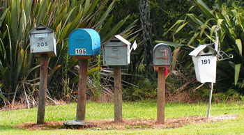
The Permanent Committee on Addressing (PCA) provides leadership in addressing, road naming, and locality definition. This includes setting standards, developing guidelines, and promoting systems for the efficient interchange and sharing of address data.
Activities During 2012–2014
- Distribution was completed of the 4819/2011 standard to all local councils in Australia and NZ.
- Work is continuing on developing Addressing Guidelines to be issues to promote AS/NZ 4819 addressing standard.
- ANZLIC’s Foundation Spatial Data Framework identifies ‘Geocoded Addressing’ as one if its ten spatial data themes. PCA is providing the technical leadership to specify the foundation datasets, identify the gaps between what currently exists and what is required, and to then develop some plans for closing those gaps.
Permanent Committee on the Cadastre (PCC)

Chair, Richard Browne
Chief Inspecting Surveyor, Inspector of Plans and Surveys, Landgate Western Australia
Sponsor, Bill Hirst
Surveyor–General
Planning and Land Authority, Australian Capital Territory
About PCC
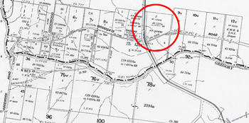
The Permanent Committee on the Cadastre (PCC) was established in 1999 to provide a leadership role in:
- advising ICSM on cadastral matters
- raising awareness of the cadastre and the benefits of the digital cadastral system to the spatial industry and the community.
Its role is to develop a coordinated approach to cadastral maintenance and improvement of digital cadastral data. This incorporates involvement with all stakeholders, including other peak government and industry groups.
Activities During 2012–2014
- Planning for a national cadastre which in part, followed the work done by Melbourne University on 3D cadastres.
- A draft strategy, Cadastre 2034 was developed and launched at Locate14 conference. Following the launch, there was extensive consultations with industry, academia, government, legal and research groups for their comment on the strategy. A final document will be prepared which incorporated many of these suggestions and comments.
- Published and updated Fundamentals of Land Boundaries as web pages.
- Assisting University of Melbourne with further research into 3D cadastre.
- Supported ANZLIC and the Commonwealth Spatial Policy Branch on the Land Parcel and Property Theme of the Foundation Spatial Data Framework.
ePlan Working Group (ePlan)

Chair, Nevil Cumerford
Project Leader EARL,
Cadastral and Geodetic Services, Land and Spatial Information Group
Land and Indigenous Services, Queensland
Sponsor, Michael Giudici
Surveyor–General
Department of Primary Industries, Parks, Water and Environment, Tasmania

About e–Plan
This committee was established in November 2003 when it was recognised that a national cadastral data transfer standard was needed to capitalise on the inherent efficiencies that electronic lodgement and processing of digital cadastral data can bring.
The ePlan Working Group is composed of representatives from industry and government to review and progress this change. In late 2010 the ePlan group published the Australian ePlan Protocol and moved its focus from the Development of the Protocol to implementation within the Jurisdictions.
Activities during 2012–2014
Since the ratification by ICSM, and subsequent publishing to individual software vendors, of the ePlan protocol in October 2010, interest within the industry and vendors has increased. Several states have successfully engaged local and multi-national firms with a presence in Australia.
During this two year period, Victoria and New South Wales have been successful in accepting electronic lodgements of survey plans in XML format. Further developments include:
- Victoria released an enhanced version of SPEAR and received their first lodgement used in the production process in May 2013. So far, 22 ePlans have been submitted to SPEAR from 5 surveying organisations. Further investigation to the requirements for supporting more application types is currently being undertaken. Ongoing enhancements to all systems in the lodgement and registration process aim to provide a complete service to industry.
- NSW received the first of its 45 ePlan lodgements in September 2012. An internal business process to examine digital plans has also been developed and is in production. An electronic workflow management system has been implemented to complete the digital process from lodgement through to registration and title creation. NSW currently have 60 surveyors testing, with 10 of those lodging ePlans, and a further 70 attending industry training courses.
- Queensland launched the enhanced version of EARL in October 2014 and is expecting their first lodgement the same month. Queensland continues to work with software vendors to enable the consumption of ePlan files and has licenses with 4 companies.
Software vendors have developed and released versions of software to create ePlan files. Several jurisdictions have been participating in industry training courses in the use of the enhanced software. Currently:
- Four software packages are fully compliant and have lodged ePlan files
- Six companies are currently undertaking beta testing
- Several other vendors are continuing development.
Collaboration between Queensland, Victoria and NSW on a solution for the visualisation of ePlan files was achieved during this period. This service is to be enhanced by the jurisdictions involved to suit their individual requirements.
Online validation and/or rendering services have been implemented in Queensland, Victoria and NSW. The validation service provides surveyors with a tool to upload and self-validate their files prior to lodgement. The rendering service enables the surveyor to render the plan image once validation is successful. These services are continually evolving to improve the quality of service and data.
New Zealand has been a member of the ePlan working group since its inception, involving representatives from Land Information New Zealand (LINZ). In the early 2000’s, LINZ introduced an integrated automated survey and title system, known as Landonline, which progressively enabled the electronic capture, lodgement, recording, and supply of title information and cadastral survey data. LandXML is a fundamental part of this system. LINZ is currently preparing a business case to government for an Advanced Survey and Title Service (ASaTS) to modernise Landonline and enhance the services around it.
Throughout 2013/14 the Singapore Land Authority has been participating in the working group. Their aim is to enter into an MOU with the ICSM to implement ePlan in Singapore. Due to the nature of subdivision activity in Singapore, their interest relates to 3D building subdivisions.
At a meeting held in Sydney in May 2014, the working group updated their Terms of Reference to include the implementation of 3D cadastres, the maintenance of the protocol in line with 3D cadastres and aligning the Protocol with the Land Administration Data Model (LADM). As a result, a technical working group has recently been formed to deal with technical issues and begin discussion on the future of the ePlan Protocol including supporting 3D building subdivisions, which will prove to be the next big challenge.
Permanent Committee on Geodesy (PCG)

Chair, John Dawson
Section Leader, Geodesy
Geoscience Australia, Australian Capital Territory
Sponsor, Gary Johnston
Group Leader, Geodesy and Seismic Monitoring Group
Geoscience Australia, Australian Capital Territory
About PCG
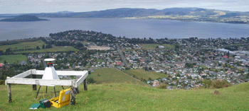
Geodesy provides the positional framework for all surveying, mapping and geographic information applications in Australia. In 2012, the Permanent Committee on Geodesy (PCG) was renamed from the Geodesy Technical Sub–Committee (GTSC). The PCG is responsible for providing advice on geodetic issues. It has existed as a series of working groups since the inception of ICSM in 1988. The PCG’s primary role is to maintain a compatible geodetic infrastructure across Australia and New Zealand.
Activities During 2012–2014
DynaNet
A collaborative project has been initiated at the National Computational Infrastructure (NCI) to facilitate a fully rigorous national geodetic adjustment. The NCI infrastructure will provide a collaborative environment on which all jurisdictions can share data and execute adjustments within a super–computing environment.
Lead by Victoria (Dr Roger Fraser), there has been ongoing development of the DynaNet software. The DynaNet software is now considered operational and is deployed onto the NCI as part of the CRCSI datum research.
Steve Tarbit (Queensland) has developed a graphical user interface (GUI) for the geodetic adjustment software DynaNet, called Zed.
National Geodetic Datum
The PCG resolved to develop a plan for national datum modernisation. This calls for the production of a new static datum in 2015 with the reference epoch of 2020 followed in 2020 fully kinematic datum.
Standard for the Australian Survey Control Network Special Publication No.1 (SP1)
The PCG has developed a new version of the Standard for the Australian Survey Control Network — Special Publication 1 (SP1), version 2.0 which will replace the Standards and Practices for Control Surveys (SP1) version 1.7. The structure of the new SP1 incorporates an overarching Standard with a series of support guidelines that detail ICSM’s recommended practices for levelling, total station surveying, GNSS, network adjustment, installation of survey marks and CORS.
Legal Traceability of Position
Geoscience Australia has been granted approval from National Association of Testing Authorities, Australia (NATA) and the National Measurement Institute (NMI) to modify its scope of accreditation. The Least Uncertainty of Position that can now been provided is 7 mm and 15 mm in the horizontal and vertical components respectively (down from 30mm and 50mm).
PCG worked with all Global Navigation Satellite System (GNSS) Continuously Operating Reference Station (CORS) operators to manage an Australia–wide certification campaign of positions in accordance with Regulation 13 of the National Measurement Regulations 1999 and the National Measurement Act 1960. The primary objective of this campaign is to improve the consistency of legal traceable CORS positions across Australia; and the stated uncertainties on previously certified stations. The ICSM Permanent Committee on Tides and Mean Sea Level (PCTSML) is also collaborating on this campaign by encouraging port authorities to observe GNSS data at tide–gauge stations simultaneously. This joint PCG and PCTSML work will underpin future efforts to improve the linkages between the land–datum (i.e. GDA) and bathymetric datums (e.g., MSL, LAT).
This campaign was undertaken from 23 — 30 June 2013, GPS week 1746 (DOY 174 – 180). As of October 2013, the PCG have received the submission of 368 stations.
AuScope Infrastructure
The AuScope GNSS CORS and gravity infrastructure build was completed. In summary, 55 AuScope funded stations have now been constructed (5 more than the 50 planned) and 44 co–funded stations will be complete by end of year (1 more than the 43 planned).
Permanent Committee on Topographic Information (PCTI)

Chair and Sponsor, Simon Costello
Group Leader, National Location Information Group
Geoscience Australia, Australian Capital Territory
About PCTI
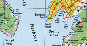
The aim of the Permanent Committee for Topographic Information is to enhance the coordination of Geographic Information Management and associated activities undertaken by the jurisdictional mapping agencies and the private sector.
Activities During 2012–2014
PCTI members discussed the ANZLIC request to provide a stock take report on Topographic Products in Australia and New Zealand — the products, collection the maintenance, and who produce and distribute (supply chain) topographic information/products.
A process that had been undertaken to clarify the original ANZLIC question through ICSM, with work being undertaken to compile a survey and prepare the final response and supporting documentation:
- Executive Summary report addressing ANZLIC action items
- Survey Analysis Report of survey results
- Survey Matrix – collation of survey results
- Survey template – original survey template sent out to PCTI members.
PCTI were then asked by ANZLIC to continue investigating the issues and demands for topography product.
PCTI members provided high level topographic use case scenarios to (a) build the business case on the application of topographic data and (b) provide examples to the Foundation Spatial Data Framework (FSDF) of business uses for elevation and bathymetry, transport, water and land cover. PCTI is also reviewing prepared FSDF dataset profiles for transport, buildings and the coastline. A document was prepared to show the alignment of current topographic information to the FSDF
Many jurisdictions are utilising Globes to enable data discoverability and information promotion. There is tangible evidence of a significant uptake in general use where the Globes have been implemented. Servicing the Globes is the high uptake in using web services for data discoverability and access.
National Topographic Information Coordination Initiative (NTICI)
National Topographic Information Coordination Initiative (NTICI) project agreements under the ICSM Collaborative Head Agreement (CHA) have been undertaken with Northern Territory, ACT and Western Australia for the revision, maintenance and sharing of topographic information.
The focus has been on the development of the National Rural and Remote Buildings Project to form a consistent national data theme. Data will be delivered to South Australia after validation and testing. Scoping has begun on the next stage of the project to revise buildings in Queensland.
Other NTICI projects completed include: the NSW Town Scenes, Kakadu, South East Tasmania Infrastructure, Queensland Infrastructure (selected areas) and the Gippsland project. Several projects have since begun with Northern Territory and Queensland to capture coastline information to progress priority Maritime Boundary work.
Transport Working Group (TWG)

Chair, Simon Costello
Group Leader
National Location Information Group,
Geoscience Australia, Australian Capital Territory
Sponsor, Bill Hirst
Surveyor–General,
Planning and Land Authority, Australian Capital Territory

Activities During 2012–2014
The group has been providing advice to Foundation Spatial Data Framework through a briefing for ANZLIC as input into the Foundation Spatial Data Framework. The briefing included:
- Summary of user requirements based on liaison with Austroads, emergency management, defence, transport and planning agencies, and grants commissions. Use cases were developed around these government uses, likely innovation in the private sector (particularly around intelligent transport and in-car navigation systems), and general commuter/tourist needs.
- An “aspirational state” document outlining coverage, access, accuracy, currency and standards for seven nominal transport datasets (road, rail, airfields, routes, crossings, control devices, intermodal transfer locations/railway stations, and navigation aids/hazards).
- A gap analysis showing where jurisdictions existing datasets met the aspirational needs. (This was based on quality of information supplied to PSMA as part of the implementation of the Roads model.)
The TWG’s major work has been translating its earlier work in data model development and stakeholder needs for roads into the relevant FSDF theme profile and dataset profile. The next phase will be to develop national models for rail, air and marine transport.
Points of Interest Working Group (POIWG)

Chair, Marty Stamatis
Manager, Location Data Management
Landgate, Western Australia

Activities During 2012–2014
- An audit of the current status of POI datasets in each of the jurisdictions.
- Comparison of the feature categories provided by the various jurisdictions; includes Ordnance Survey and ANZSIC codes.
- A jurisdictional project (Western Australian) has investigating the viability of using the Australian Business Register (ABR) data as a source of POI. A report has been compiled and circulated to the SIG for comment. It presents the analysis of the dataset and gauges its suitability as a source of POI information. It provides a gap analysis against jurisdictional data to help identify which POI categories jurisdictions need collect.
- CRCSI Project 3.02 (Semantic Web Technologies for Supply Chain Management of Spatial Infrastructures) will provide resources at no cost, to assist with Supply Chain Management with respect to Points of Interest data.
(Permanent) Committee for Geographical Names in Australasia (CGNA)

Chair, William Watt
Manager, Roads and Crown Support
Department of Planning, Transport and Infrastructure, South Australia
Sponsor, John E Tulloch
Surveyor–General of Victoria
Department of Sustainability & Environment, Victoria

About CGNA
Our role is to coordinate and communicate the consistent use of place names to ensure they meet the requirements of the whole community, including government bodies and emergency services; and also indigenous people.
Through CGNA, Australia and New Zealand participate in the activities of the United Nations Group of Experts on Geographical Names (UNGEGN) and contribute to world best practice in the management of place names.
Activities During 2012–2014
Mr Bill Watt was elected unopposed to the position of Chair of United Nations Group of Experts on Geographical Names (UNGEGN) for a five year term from 2012 until 2017.
The 2012 National Gazetteer was released which included a version of the gazetteer in KML format as well as the previous delivery formats.
There was increased recognition by the Spatial Industry that geographic names play a role across most of the FSDF themes. Names are and will continue to be the most commonly used spatial identifier. They are valuable for indexing and linking information in various spatial datasets. Conceptual modelling for the FSDF Place Name Theme has commenced in the absence of firm requirements. This has been based on experiences and lessons learned in the Administrative Boundary modelling activity. The principles of “adopt, adapt and extend” guide the modelling process.
In addition, knowledge of existing gazetteer data and future use/requirements for gazetteers from conversations with CGNA in the context of the CSIRO Spatial Identifier Reference Framework Project are providing valuable contextual knowledge to guide this activity.
Indications from initial FSDF Place Names Theme discussions, are that there are likely to be two broad categories of products that will be covered under the theme:
- Gazetteer products — official list of places focused on naming with representative location,
- Feature/Point of Interest features — it is not clear what the scope of this is. A model is being developed to provide a scalable extensible framework to handle points/features of interest.
Permanent Committee for Tides & Mean Sea Level (PCTMSL)

Chair and Sponsor, Commodore Brett Brace
Director General Navy, Hydrography and METOC
Hydrographer of Australia

About PCTMSL
The main role of the Permanent Committee for Tides and Mean Sea Level is to coordinate a national database of tidal records as well as develop national standards and best practice guidelines for tidal related matters. PCTSML also acts as a focal point for national inquiries relating to tides and mean sea level and identifies long-term tide and sea level management requirements for Australia and New Zealand.
Activities During 2012–2014
The PCTMSL made significant progress in respect of linking all tide gauges through their bench marks to the ellipsoid and also establishing the reference surfaces (Highest Astronomical Tide (HAT), Lowest Astronomical Tide (LAT), Chart Datum (CD), etc) in relation to each tide gauge. It has sought considerable information in respect of this from various State and federal organisations to date and received data for 80% of the total stations (131 continuous monitoring tide gauges). Work relating to next phase of the project has commenced, to review the 2,000+ non-continuous operating tide-gauges for priority in connecting to the ellipsoid.
The revision of the Australian Tides Manual (SP9) Version 4.2 was completed in October 2013.
PCTMSL continues to work with the Bureau of Meteorology’s National Tidal Centre (NTC) and the Australian Hydrographic Service to hold annual tides workshops providing training for people involved in tidal data collection, analysis and prediction. The workshops are held at the NTC’s office in Adelaide. Topics covered include:
- tidal theory
- storm surges and extreme events
- instrumentation
- real-time systems with meteorological sensors
- benchmark levelling and datums
- data analysis and quality control
- archiving and quality assurance.
The CRC for Spatial Information (CRCSI) UDEM2 Project 3 has developed a coarse vertical datum transformation tool (AusCoastVDT) using the AHS Tidal Polygon Network (TPN) data. The tool is hosted on the ICSM website so that users can provide feedback regarding its suitability for their requirement and indicate if any further refinement of the model is needed.
ICSM Website
The ICSM website continues to be a popular resource for students, spatial specialists and the general public with the most visited pages being the Fundamentals of Mapping package, GDA technical manual, Standards and Practices for Control Surveys and other general interest items.
The website is the featured communication channel for ICSM to publish discussion papers, documentation and tools for use by the spatial community. We always welcome feedback and suggestions through our email icsm@ga.gov.au on any improvements or corrections to information contained on the website.
The web statistics show a continued growth in visits to the site which now has well over 1,600,000 page views each year, from beginnings when the site was launched in 2002 of less than 300,000. The most visited pages are the Fundamentals of Mapping package with over 450,000 page views each year, followed by the GDA Technical Manual over 300,000 views.
With the launch of the discussion document “Cadastre 2034”, there were nearly 300,000 page views, which resulted in many comments and suggestions being submitted for the preparation of the final strategy.
Financing Our Work
|
The operating deficit for this period was drawn from reserves to engage external expertise to assist ICSM projects when necessary.
Activities and Events
As part of our policy of engaging with spatial professionals; over the two years covered by this report, ICSM has had a significant presence at the following events:
- Locate14 Conference — Canberra, April 2014
- United Nations Group of Experts on Geographic Names (UNGEGN) Congress
- United Nations Committee of Experts on Global Geographic Information Management (UNGGIM)
- United Nations Permanent Committee on GIS Infrastructure for Asia and the Pacific(PCGIAP)
As part of our strategy of informing about our activities; we:
- release the Minutes of ICSM Meeting every 6 months
- publish our Biennial Report every 2 years
- publish the ICSM Newsletter every 6 months
- routinely publish general information material.
ICSM Members
AUSTRALIA — Civilian
Simon Costello
Group Leader,
National Geographic Information Group
Geoscience Australia
Gary Johnston
Group Leader,
Geodesy & Seismic Monitoring
Geoscience Australia
AUSTRALIA — Defence (Navy)
Commodore Brett Brace, RAN
Hydrographer of Australia
Australian Hydrographic Service
AUSTRALIA — Defence (AGO)
Graham Johnston
Assistant Director Operations,
Geospatial Analysis Centre Australian Geospatial–Intelligence Organisation (AGO)
NEW ZEALAND
Mark Dyer
Surveyor–General
Land Information New Zealand
AUSTRALIAN CAPITAL TERRITORY
Bill Hirst
Surveyor–General Environment & Planning Directorate
NEW SOUTH WALES
Paul Harcombe
Deputy Surveyor–General of NSW Land and Property Information
NORTHERN TERRITORY
Craig Sandy
Director, Surveys
Department of Lands, Planning & the Environment
QUEENSLAND
Dr Russell Priebbenow
Director of Surveys
Spatial Information Group
Department of Natural Resources and Mines
SOUTH AUSTRALIA
Michael Burdett
Surveyor–General
Land Boundaries,
Information & Strategy
Department of Planning, Transport and Infrastructure
TASMANIA
Michael Giudici
Surveyor–General
Land Tasmania
Department of Primary Industries,
Parks, Water & Environment
VICTORIA
John E Tulloch
Surveyor–General of Victoria
Department of Environment, Land,
Water & Planning
John Gallagher
Manager
Spatial Information Infrastructure
Department of Environment, Land,
Water & Planning
WESTERN AUSTRALIA
Paul Duncan
Director
Location Knowledge Services
Landgate
ICSM Executive Officer
Lesley Waterhouse
ICSM Executive Officer
Geoscience Australia
Email: icsm@ga.gov.au
Phone: (02) 6249 9677
Mobile: 0419 694 669

Australia–Civilian
Geoscience Australia
GPO Box 378
CANBERRA ACT 2601
Within the Commonwealth portfolio Resources, Energy and Tourism, Geoscience Australia takes a lead role in producing national geoscientific information and knowledge. Key areas of activity include data acquisition, analysis and dissemination, research and advice associated with:
- topographic mapping and data
- pre-competitive petroleum exploration
- pre-competitive onshore mineral exploration
- coastal zone and sea-bed mapping, including Australian Marine Spatial Information System (AMSIS)
- risk analysis and modelling to support national initiatives for Disaster Mitigation Australia, counter terrorism and critical infrastructure protection
- seismic and geodetic monitoring
- Australian National Tsunami Warning System (ATWS)
ICSM Executive Officer
Tel: +61 2 6249 9677
or (02) 6249 9677
Email: icsm@ga.gov.au
The Executive Officer of ICSM:
- provides Secretariat support to the Committee
- provides project support to ICSM and ICSM working groups
- maintains the ICSM website.
The Secretariat was provided by Geoscience Australia during this reporting period.
Australia — Defence

Australian Hydrographic Service
Locked Bag 8801
WOLLONGONG NSW 2500
The Australian Hydrographic Service (AHS), a part of the Royal Australian Navy, is the organisation responsible for hydrographic surveying, national charting and the provision of hydrographic services that meet Australia’s national obligations as a signatory to the United Nations Convention on Safety of Life at Sea (SOLAS). This role requires the coordination and determination of policy and standards for hydrographic surveying and charting, as well as contributing to the national collection, coordination, exchange and metadata standards for maritime geospatial data.
The AHS is also responsible for providing maritime military geospatial information in direct support of the Australian Defence Force mission.
Australian Geospatial-Intelligence Organisation (AGO)
PO Box 2793
BENDIGO VIC 3551
The Australian Geospatial–Intelligence Organisation (AGO) — formerly Defence Imagery and Geospatial Organisation (DIGO) is the lead geospatial and imagery intelligence organisation in the Department of Defence. Its functions, as described in the Intelligence Services Act 2001, include meeting the operational, targeting, training and exercise requirements of the Australian Defence Force; supporting Commonwealth and State authorities in carrying out national security functions and to provide Commonwealth and State authorities and bodies imagery and other geospatial products in support for carrying out their emergency response functions.
AGO continues to produce mapping over many training areas in Australia and its production program also includes assisting its neighbouring SE Asian nations with their mapping programs. This currently sees AGO mapping PNG and its Island Groups to the North. Vanuatu, Solomon Islands have now been completed and delivered. The programs provide these countries with up to date mapping coverage in both hardcopy and digital format, included with this is the delivery of systems and training to ensure each nation has its own indigenous capability.
New Zealand
Land Information New Zealand
PO Box 5501
WELLINGTON NEW ZEALAND

Land Information New Zealand (LINZ) is responsible for providing New Zealand’s authoritative land and seabed information. This covers responsibility for the geodetic reference system, the cadastral survey system, topographic mapping, hydrographic charting, geographic names, the land title system, Crown property, the valuation rating system, electoral boundaries and continental shelf boundaries.

Australian Capital Territory
ACT Environment and Sustainable Development Directorate
GPO Box 1908
CANBERRA ACT 2601
The Surveyor–General for the ACT is a statutory appointment under the Surveyors Act (2007). The Surveyor–General maintains the ACT’s secure system of land ownership and tenure by ensuring that land boundaries are unambiguously defined and accurately recorded. The Surveyor–General’s responsibilities include standards for surveying and the regulation and licensing of surveyors in the Territory. The Surveyor–General manages the Office of the Surveyor-General within the ACT Environment and Sustainable Development Directorate. Through this office the Directorate produces, updates and maintains and distributes a range of land information including a most comprehensive and accurate cadastral database. It also checks survey plans, opens and closes roads, provides and maintains an extensive survey control network and manages a unique place and road naming infrastructure.
New South Wales

Land and Property Information
PO Box 15
SYDNEY NSW 2001
Land and Property Information provides a variety of land administration and land management products and services. These include land ownership information, surveying and mapping, land valuation services, stewardship and development of Crown lands and soil, water and environment conservation works and consultancy services.
Our products and services underpin the economic well being of the State of New South Wales by providing sound, accurate land information, which assists in generating economic growth and investment in New South Wales, and informing planning, policy development and decision making across the public sector.
Northern Territory

Department of Lands and Planning
GPO Box 1680
DARWIN NT 0801
The Department of Lands and Planning is the lead agency for land administration and spatial information in the Northern Territory Government. Spatial information is largely delivered through the business units of the Land Information Division as follows:
- Survey — provides the statutory functions of the Surveyor–General, geodetic and cadastral (or land boundaries) infrastructure and supports the Place Names Committee and Surveyors Board for the Northern Territory
- Land Information — provides whole of government aerial photography, satellite imagery and topographic information programs, generates products and services from integrating spatial data and delivers services through Land Information Centres
- Valuation — provides the statutory functions of the Valuer-General for both commercial land and property valuations for the Northern Territory and local governments
- Land Information Systems — provides integrated spatial information systems and services to the department and other government agencies and coordinates land information initiatives across Northern Territory, local and Australian governments.
Queensland
Department of Natural Resources
and Mines
GPO Box 2454
BRISBANE QLD 4001

The Department of Natural Resources and Mines (DNRM) is committed to the sustainable use of Queensland's natural resources: our land, water and minerals. The management of the state's natural resources is central to delivering economic, environmental and social benefits to all Queenslanders. The department also provides support for the safety and health of all Queensland miners and people working in allied industries.
DNRM has five main areas of service delivery:
- mining and petroleum
- natural resources operations
- land and indigenous services
- water and catchments
- mine safety and health.

South Australia
Department for Transport, Energy
and Infrastructure
GPO Box 1354
ADELAIDE SA 5001
Land Services Division is a business unit within the Department for Transport, Energy and Infrastructure and has a lead role for land administration within South Australia through the provision of:
- a survey infrastructure
- a guaranteed system of land titling
- an impartial property valuation service
- land and property information.
The Group includes the statutory offices of the Registrar–General, Surveyor–General, and Valuer–General and provides a range of land administration products and services to government and the community.
Tasmania

Department of Primary Industries, Parks, Water and Environment
GPO Box 44
HOBART TAS 7001
The Department of Primary Industries, Parks, Water and Environment (DPIPWE) drives sustainable development of Tasmania’s natural resources by playing a central role in industry development, natural resource management, land information services and the conservation of our natural environment.
Our broad range of services include: agriculture; fisheries and aquaculture; land and water resource management; nature conservation; Crown land management; quarantine; Service Tasmania shop management; and land title, valuation and mapping services.
The Information and Land Services Division provides services that maintain the security of land tenure, including the collection and maintenance of core land datasets and the State's cadastral mapping system. The Division also provides access to land-related information through the Land Information System Tasmania (LIST) web interface.
Victoria
Department of Environment, Land, Water & Planning
PO Box 500
EAST MELBOURNE VIC 3002
The Department of Environment, Land, Water and Planning creates liveable, inclusive and sustainable communities that support jobs and growth in Victoria. We recognise the link between the built and natural environment in the quality of our lives, and work to accommodate population growth while maintaining world class liveability and protecting our heritage for future generations.
Western Australia

Landgate
PO Box 2222
Landgate is the statutory authority responsible for Western Australia’s land and property information.
Landgate maintains Western Australia’s official register of land ownership and survey information. It plays a key role in providing quality data, secure information systems and valued services vital to the efficient functioning of the land and property market, and the State’s rating and taxing base.
Between 40 and 50 per cent of State and local government revenues rely upon Landgate data, which demonstrates how the authority’s functions underpin the operations of government, industry and the economy.
Landgate has a leadership role in bringing industry and government stakeholders together as part of an integrated spatial information industry in the State. By opening up access to government data and increasing its use, Landgate delivers economic, environmental and social benefits to Western Australia.
Landgate also continues to provide a wide range of reliable land, property and spatial information products and services that meet customer needs.
Acknowledgements
Graphic Design with thanks to Geoscience Australia

