  • ""
Intergovernmental Committee on Surveying and Mapping logo
  • About
    • Our Role
    • ICSM Strategic Plan
    • Communication
    • Legal
    • Links to Associated Web Pages
  • What we do
    • Addressing
      • PSMA's Geocoded National Address File (G-NAF)
      • Standards for rural and urban addressing (AS4819)
    • AGRS
      • The Australian Geospatial Reference System
    • AusHydroid
    • Cadastre Working Group
      • 3D Cadastral Survey Data Exchange Program
      • Accuracy
      • Cadastre 2034
    • Geodesy
      • Geodesy - National Survey Control
    • GDA2020
      • GDA2020 Fact Sheets
      • Using the GDA2020 Logo
        • GDA2020 Logo Disclaimer
          • GDA2020 Logo Terms and Conditions
    • Elevation, Depth and Imagery
      • Elevation Data
    • Metadata
      • Metadata Working Group Documents
    • Place Names
      • Place Names Working Group
        • History and Legacy
      • Australian Place Names
      • New Zealand Place Names
      • Community Domain Names
    • Tides and Mean Sea Level
    • Topographic Information
    • Previous Working Groups
      • Transport Working Group
      • Water Special Interest Group
      • SIDA Special Interest Group – Spatial Information Delivery and Access
    • Electronic Lodgement and Transfer of Survey Data Working Group (Not active)
  • Education
    • Australian Antarctic Gazetteer
    • Australian Tides Manual
    • Fundamentals of Land Ownership, Land Boundaries and Surveying
    • Fundamentals of Mapping
    • Gazetteer of Australia
    • Feature Catalogue
    • What’s in a Name? - video
    • Maritime Gazetteer of Australia
    • Useful Links to Other Sites
  • Publications
  • Contact
    • Executive contacts
    • Member contacts
  • Cadastre 2034

Breadcrumb

  1. Home
  2. The Australian Geospatial Reference System
  3. Geocentric Datum of Australia 2020

In this section

  • Webinar series on Australian Geospatial Reference System
  • Zero is Priceless: The Importance of Geodesy
  • Upgrades to the Australian Geospatial Reference System
  • Australian Datums (and how to move between them)
  • Geocentric Datum of Australia 2020
    • What is changing and why?
    • GDA2020 Fact Sheets
    • GDA Transformation products and tools
    • GDA Modernisation Implementation Working Group
    • GDA Frequently Asked Questions
    • GDA2020 Forum
    • GDA2020 and GDA94 Technical Manuals
    • Using the GDA2020 Logo
  • Australian Terrestrial Reference Frame
  • Australian Height Datum
  • Australian Vertical Working Surface
  • Geodetic Standards
  • Connect with us
  • Geocentric Datum Of Australia 1994 (GDA94)
  • Australian Geodetic Datum 1966/84 (AGD)

In this section

  • Addressing
  • AGRS
  • AusHydroid
  • Cadastre Working Group
  • Geodesy
  • GDA2020
    • GDA2020 Fact Sheets
    • Using the GDA2020 Logo
  • Elevation, Depth and Imagery
  • Metadata
  • Place Names
  • Tides and Mean Sea Level
  • Topographic Information
  • Previous Working Groups
  • Electronic Lodgement and Transfer of Survey Data Working Group (Not active)
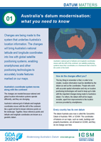
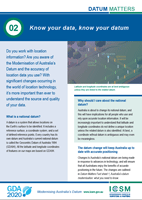
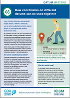
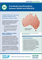
Fact sheet 1: Modernising Australia’s datum: what you need to know
Fact sheet 2: Know your data, know your datum
Fact sheet 3: How coordinates on different datums can be used together
Fact sheet 4: Coordinate transformations  between GDA94 and GDA2020


TECHNICAL Fact Sheet 1: GDA94 to GDA2020 transformation


TECHNICAL Fact Sheet 2: Using GDA2020 with CORS


Fact Sheet 5:  Preparing metadata for GDA2020 and the AGRS

Fact Sheet 6:  GMIWG Advisory on WGS 84 and Web Mapping - 15 June 2020

Datum Research Projects

  • Mercury & North Road - Handling of 4D coordinates in desktop GIS
  • North Road - Lessons learnt and recommendations for handling GDA2020 within geospatial software development.
     
  • GDA2020 Legislation Impacts Project Report

Book traversal links for GDA2020 Fact Sheets

  • ‹ What is changing and why?
  • Up
  • GDA Transformation products and tools ›

Footer Menu

About

  • Our role
  • Communication
  • Strategic plan
  • Copyright
  • Disclaimer
  • Privacy
  • MEMBERS Section

What we do

  • Addressing
  • Cadastre
  • Elevation Depth & Imagery
  • Geodesy
  • Metadata
  • S-100WG
  • Australian Branch S-100WG
  • NZ S-100WG
  • Place Names Working Group
  • Topographic Information
  • Tides and Mean Sea Level

Education

  • Fundamentals of Mapping
  • Fundamentals of Land Ownership
  • Australian Tides Manual
  • Gazetteer of Australia
  • Upgrades to the Australian Geospatial Reference System

Publications

  • Australian Tides Manual
  • Control Surveys (SP1)
  • GDA2020 Technical Manual

ABN 33 830 643 298

Website by Oxide

©  Commonwealth of Australia on behalf of ICSM