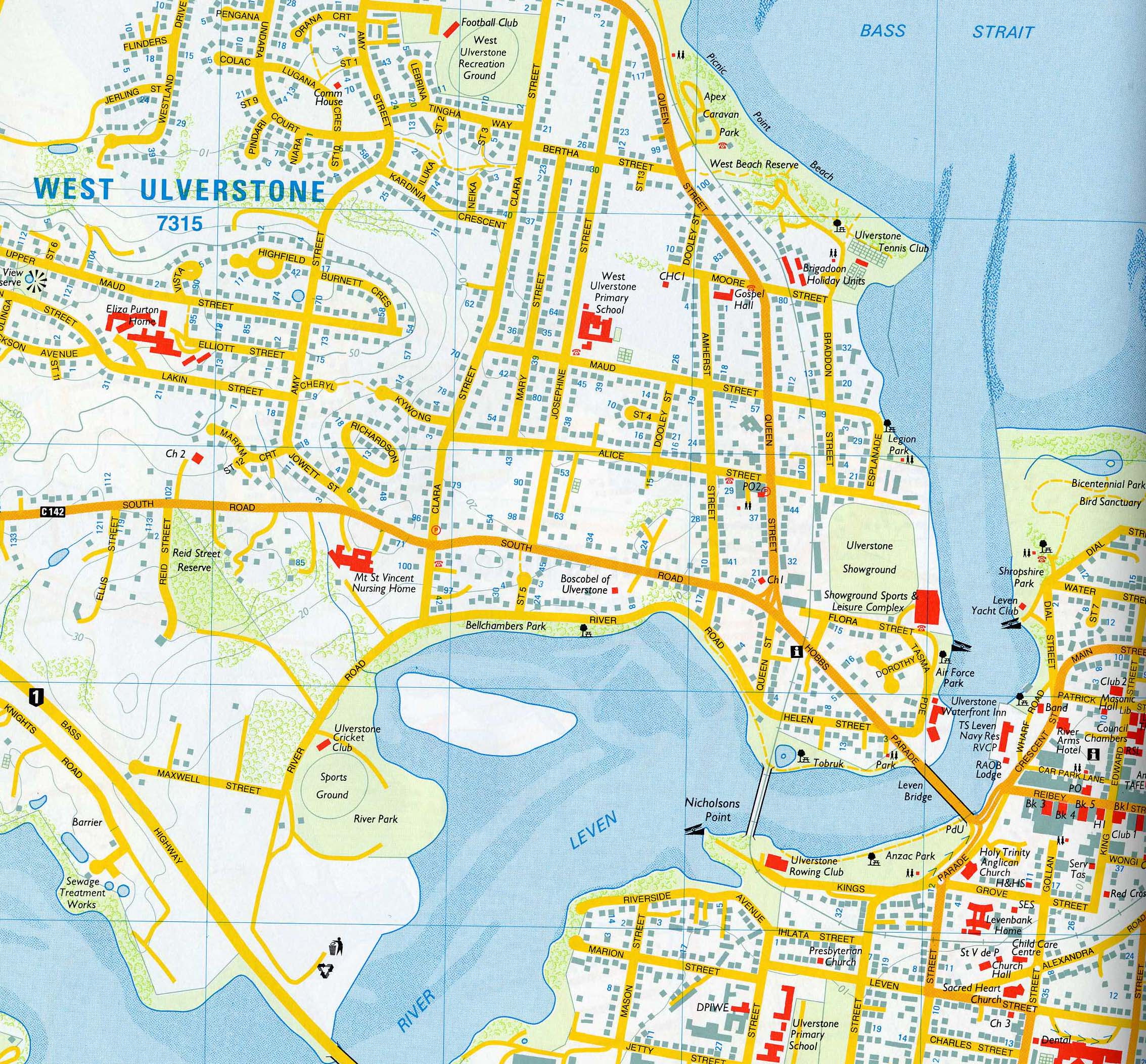
General Reference Maps
These are simple maps showing important physical (natural and man–made) features in an area. Their main purpose is to summarise the landscape to aid discovery of locations. They are usually easy to read and understand. Most of the early mapping of the Earth falls into this group.
General Reference maps often enlarge or emphasis some features to aid users. For example, road maps show roads boldly and may use road widths and colour to distinguish between major and minor roads.
As a general rule, General Reference Maps would only show relief (the difference in height between features on the map) in a stylised manner. Street and tourist maps are good examples of general reference maps.
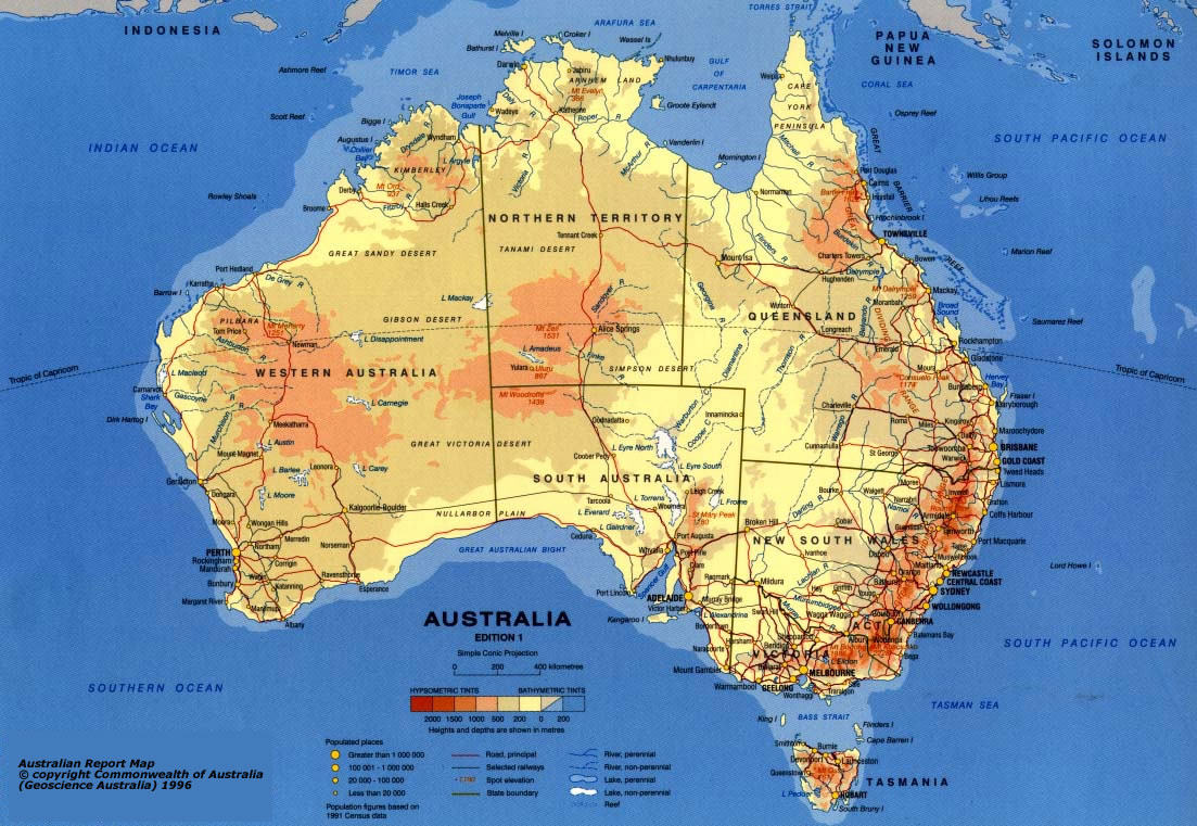
- is colourful
- cities are named
- major transport routes (highways and railways) are identified
- natural features such as rivers, lakes and mountains are named
- elevation is shown using a simple colour shading
- has themes included – eg city population size
Image courtesy of Mapland, Department of Environment, Water and Natural Resources, SA.