These are maps which depict information on a particular topic or theme. The detail portrayed on a thematic map may be physical, statistical, measured, or interpreted, and sometimes requires specialist knowledge by the map user.
Weather, population density and geology maps are examples of thematic maps.
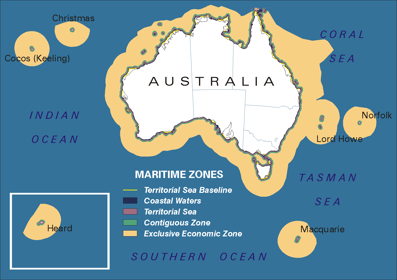
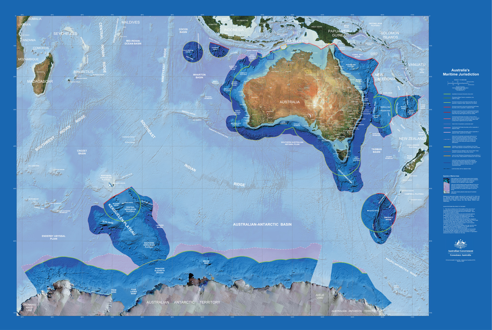
Two very different thematic maps on the same topic – Australia's Maritime Boundaries. They illustrate the principle that maps are made for a specific reason, and this dictates the amount of detail they contain.
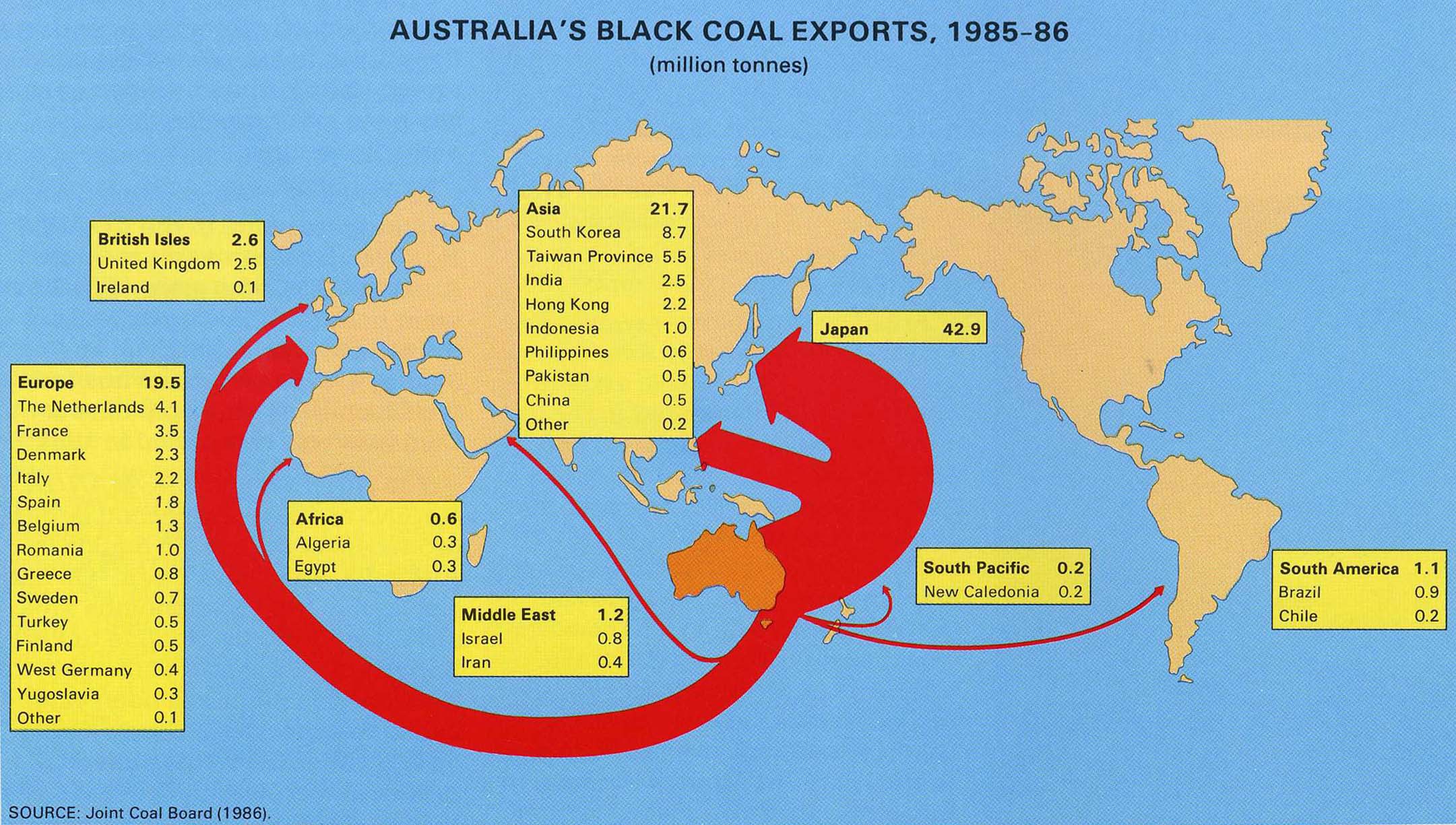
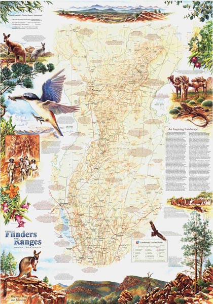
The first is a simple map, with very little base or location information. The second is a far more detailed map. It has a significant amount of base information and a dense pattern of latitude and longitude lines which allow the reader to accurately locate features shown on the map. A typical stylised thematic map, where the map itself is secondary to the information being supplied. The intent is to quickly give an impression of relative differences and the detail being supplied as tables within the map. This is an example of a map which is usually called a tourist map. It is a General Reference Map which has been enhanced for a specific reason – that of highlighting places of interest that people might like to visit. Because of this, it can also be described as a thematic map (the theme being tourism).
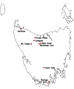
Image courtesy of Mapland, Department of Environment, Water and Natural Resources, SA.This map of limestone caves in Tasmania is an excellent example of a common type of thematic map. It is simple, with very little additional information, such as base map, a title, scale bar etc. However, it has sufficient information to allow the subject of the map to be known and the message ("where are these caves?") to be clearly told.