What is a Cadastre?
The cadastre of a country is its register of property titles and is usually managed by government agencies – in Australia these are often called Land Titles Offices. The information recorded includes an accurate description of the location of a parcel of land and who owns it. It may also record what the land can be used for (e.g. residential or not, national park etc) and may also show the location and shape of buildings. In some countries it also records the value of a property. In these cases the cadastre may also be used for land taxation purposes.
What is a Cadastral Plan?

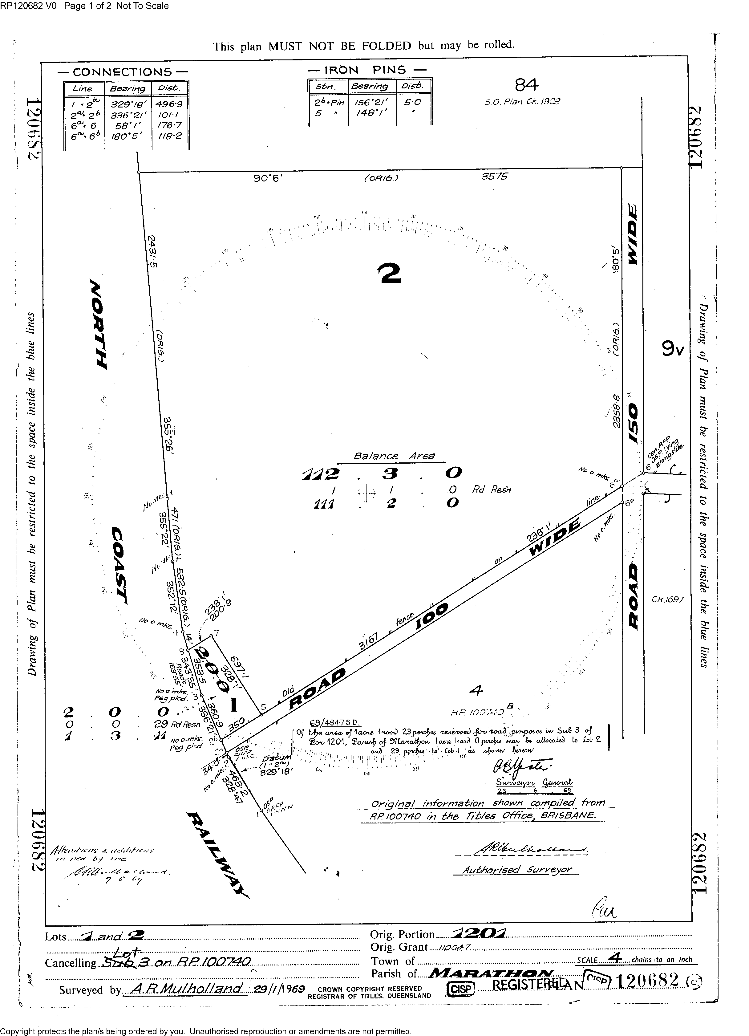
Because 2 parcels of land are shown on the one plan it is most likely that this cadastral plan was drawn when the parcel of land was sub–divided into 2 parcels.
The foundation block of a cadastre is the cadastral plan (or survey plan). This is produced by a registered ⁄ licensed surveyor who accurately measures and records the boundaries of each property. This occurs whenever a new land parcel is created and each new survey produces a new survey plan. Because of this each plan is static in time, i.e. it represents the shape and status of the cadastre at the time of survey.
Cadastral plans from different parts of the world, or indeed different parts of Australia, will contain different information – this is dependent on local legislation relating to the registering of cadastral plans into the local cadastre. A properly registered cadastral plan is a legal document.
How is a Cadastral Map different to a Cadastral Plan?
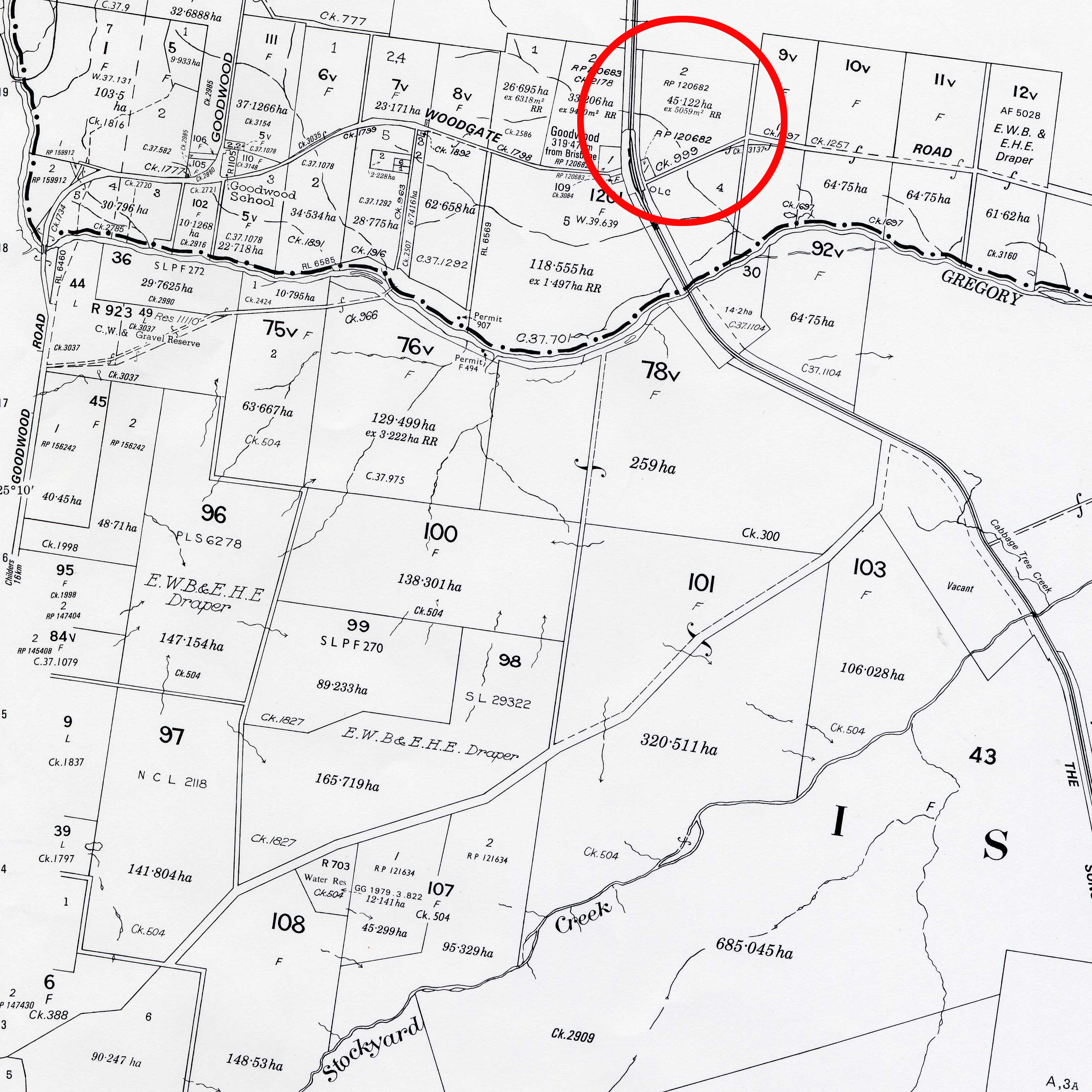
Cadastral maps are produced by joining together individual cadastral plans. A cadastral map is a general land administrative tool which has no real legislative basis (as a cadastral plan does). It is often created on demand and therefore not necessarily up–to–date. These maps are used by a broad range of people (public and professional) for all manner of things including real estate sales, valuation, Land Title Office management of the cadastre, planning etc.
Cadastral mapping is one of the best known forms of mapping, because it is the mapping that shows all of the land parcels in relation to one another and to the adjoining roads. It is also one of the most ancient forms of mapping – for example ancient Egyptians are known to have developed cadastral records so that land ownership could be re–established after the annual flooding of the Nile River.

These maps are made from numerous cadastral plans. Please note that the information shown is different to the plan. In particular, information which allows the precise dimensions of the parcel of land is no longer shown, rather individual parcels of land are identified by their relationship to each other. Some (but not all) parcels of land have additional information shown – for example how big it is (in hectares), who owns it or what it is used for (eg Gravel Reserve, Water Reserve).
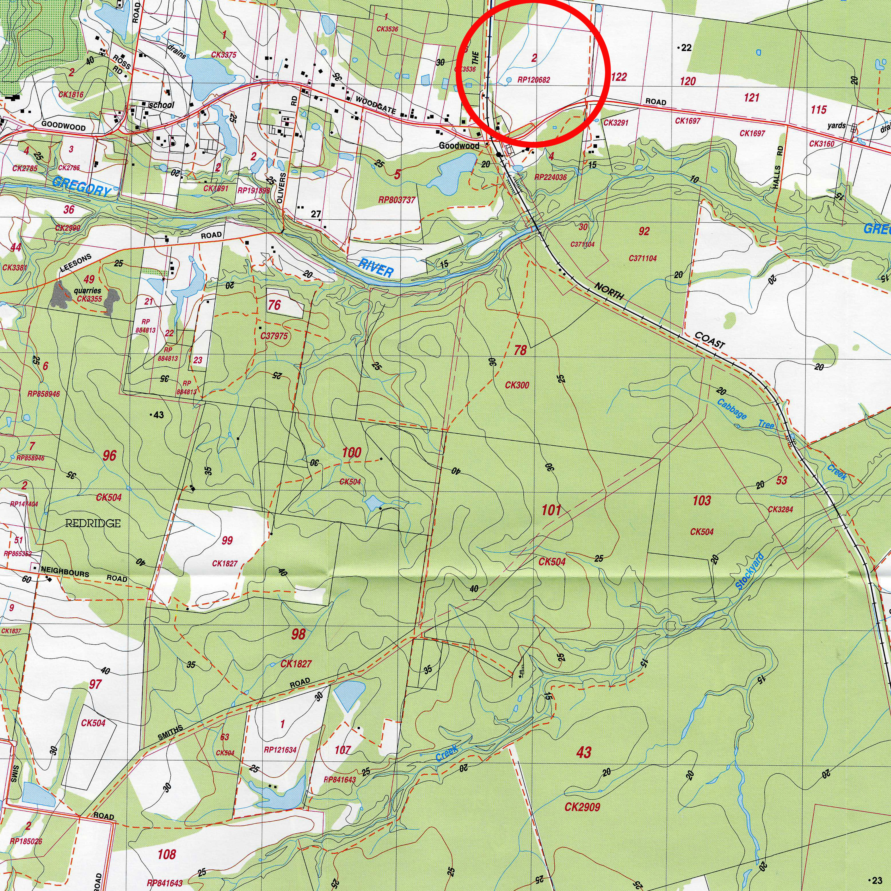
There is minimal base information supplied – mainly road and railway reserves and watercourses.
One interesting thing to note is that the cadastral plan identifies a large number of roads, but this map reveals that only a few have been built. In the jargon of the surveying industry this is referred to as the ‘planned’ environment and the ‘built’ environment.

